Ecohazards & fluid dynamics of a mixed bedrock-alluvial river
|
As a part of my postdoctoral research at SFU, I am studying ecohazards in the Fraser River in British Columbia, Canada. The 2018 Big Bar Landslide demonstrated the potentially catastrophic hazard of landslides on salmon migration. I am a part of an interdisciplinary team of researchers looking to understand the landslide history and fluid dynamics of the Fraser River and their impact on salmon migration.
My main focuses in this work are:
I am also contributing to projects on:
See this excellent video from Hakai Media describing this project |
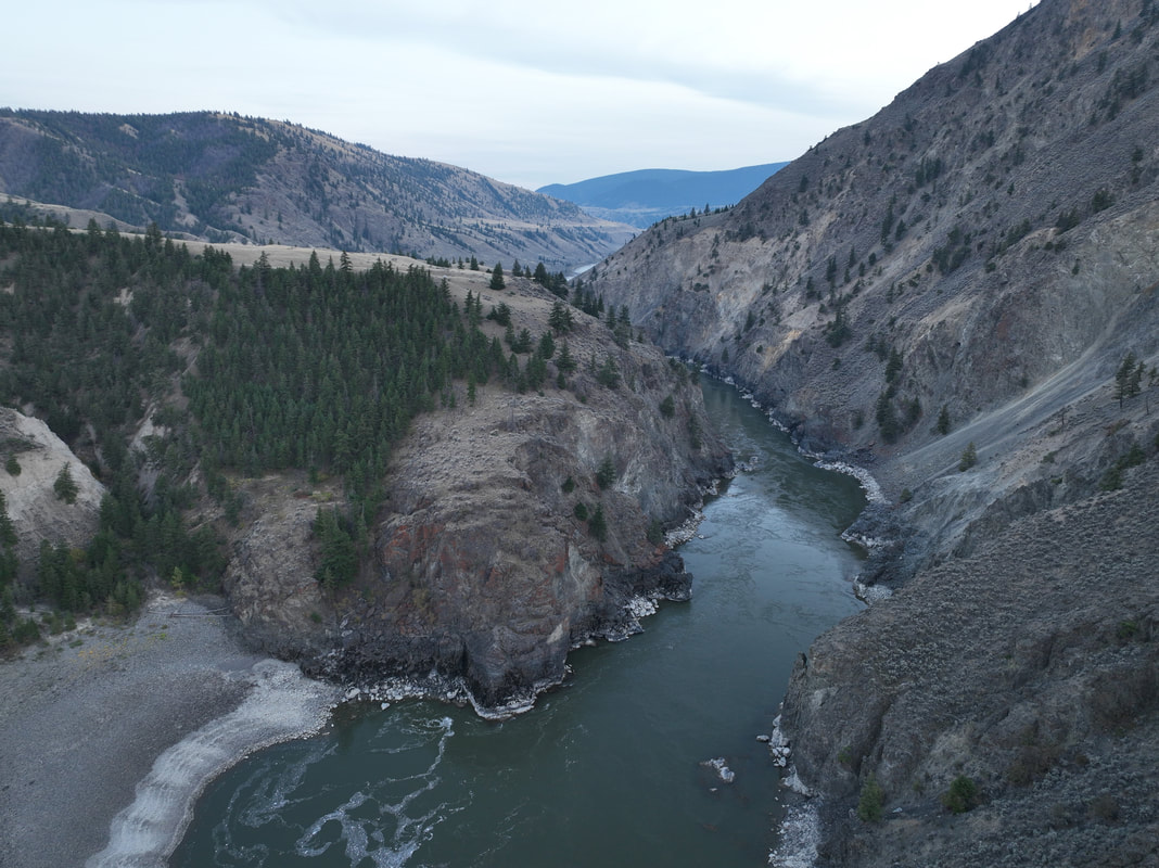
Drone photo of Iron Canyon, showing the dramatic constriction between the unconfined alluvial reach and narrow bedrock reach.
Canyons like this can represent real hazards for salmon migration, both through increased velocity in the narrow bedrock sections and through increased risk to mass wasting events like landslides and rockfalls. Photo from October, 2022
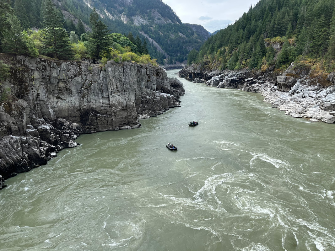
In the boats just downstream of the major drop at Hells Gate in the middle of a multibeam surveying trip (Photocredit D. Baerg)
|
Tectonic geomorphology of Taiwan
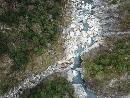
UAV photo from the Tacijili Reach (Baiyang waterfall trail in Taroko National Park), Liwu River, showing a change in channel width and sediment cover at a tributary junction
|
My main focus in my PhD research was to investigate potential feedbacks between uplift, erosion, and bedrock strength, by examining how the rate and mechanism of bedrock river incision varies across the Taiwan Central Range.
I collected a suite of paired UAV (uncrewed aerial vehicles) and field surveys to map channel morphology, sediment cover & caliber, bedrock structure, and more across over 60 kilometers of bedrock river channel. |
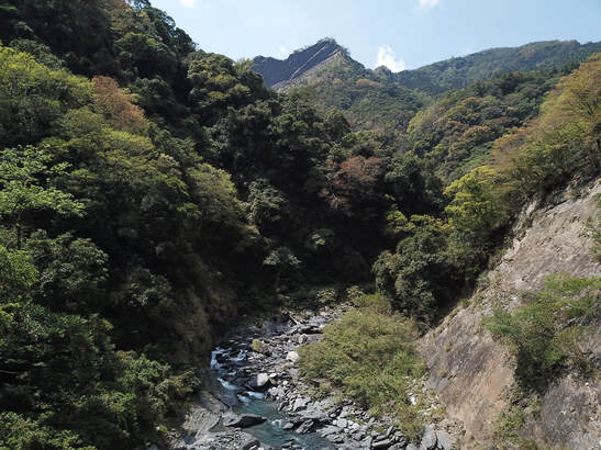
UAV photo from the Liqi river in the Western Central Range
|
|
Grain scale sediment transport and patch evolution in steep rivers
|
Bedrock rivers are dually responsible for transporting sediment and incising bedrock. However, in these steep, upland landscapes, coarse sediment from landslides, debris flows, and rockfalls enters the fluvial system. How long do these boulders reside in the channel? How do these boulders influence the overall rate of sediment transport?
I've used repeat drone and handheld photogrammetry surveys to monitor clast mobility and sediment storage over time. With these high resolution snapshot surveys, we can directly measure local deposition and erosion, boulder mobility, evolving grain size distributions, and bed roughness over time. |
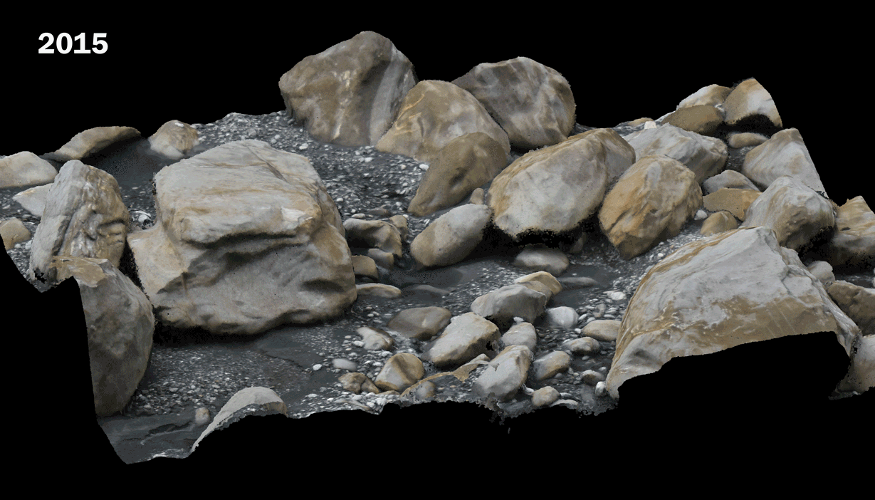
Repeat surveys of a patch in Swallow Gorge Taiwan from 2015-2019. The boulder in the center is ~12 meters in diameter for scale. Note the boulders in the background of the image (5+meters) rotating, boulders in the center (1-3 meters) being transported in and out of the patch, a full tree coming in and out of the scene, and the accumulation and subsequent erosion of cobbles throughout the patch
|
Remote sensing for forest inventory and biomass
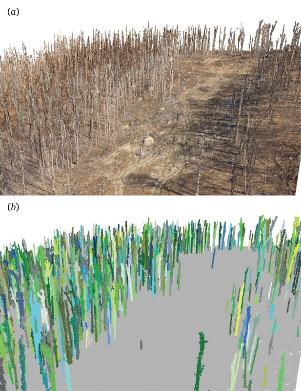
a) Point cloud of a Pennsylvania forest tornado blowdown site in April 2016, surveyed before the leaves came out; b) automatically segmented point cloud of same reach, with points colored by unique tree identification
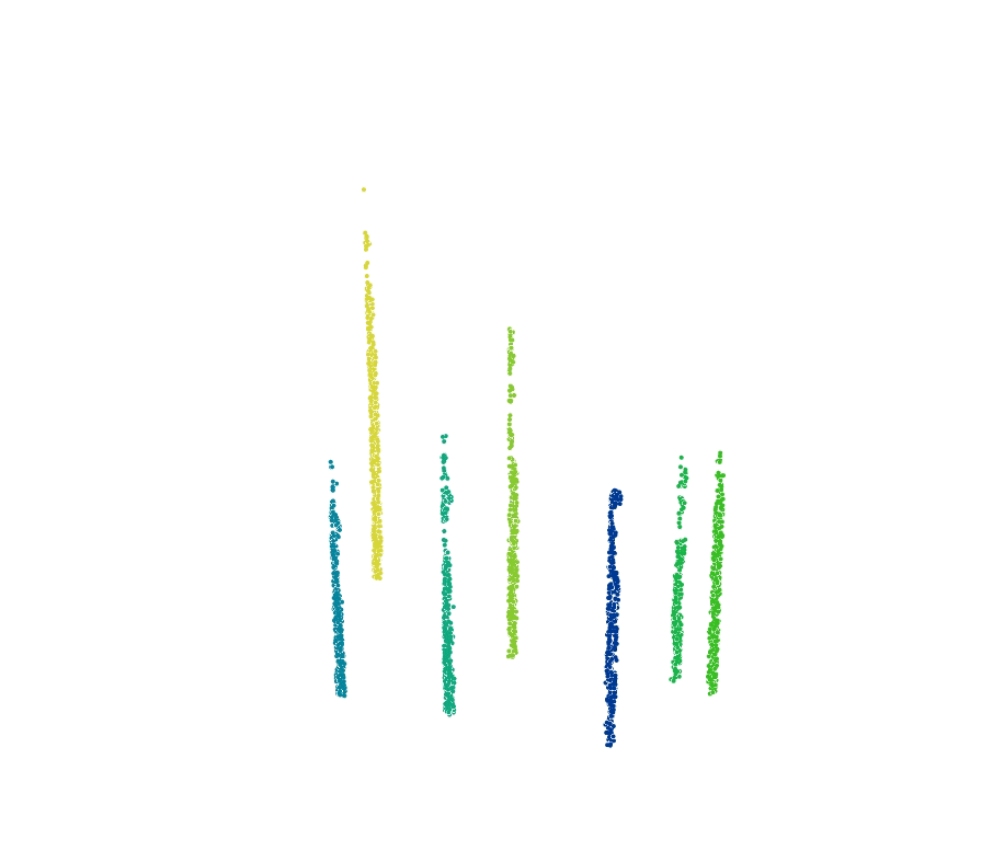
Animation of the segmentation algorithm, identifying unique trees from 3D point clouds from Carr and Slyder (2018)
|
Powdermill Nature Reserve was 'lucky' to be hit by a tornado in 2012. The storm provided a research opportunity to look at how forests recover from disturbance, and started many research opportunities for looking at how recovery is affected by practices like salvage logging, deer exclusion, and more. However, this project-- like many in forestry and ecology-- requires tracking changes across the forest at the tree and stand level over time.
I worked on developing methods to efficiently monitor the forest and track its recovery, using relatively cheap, consumer grade UAVs and structure from motion photogrammetry. We then developed an automated workflow in GIS that would identify the position, structure, and diameter of each tree in the surveyed region. These tools can be used for rapidly measuring biomass in deciduous forests, as well as tracking change at the tree level. Publications:
|
Virtual reality for geoscience education
|
I contributed to developing a suite of virtual reality field trips (VFTs) that can be used to supplement and expand existing field opportunities. Current VFTs include using earthquakes and volcanoes to explore plate tectonics, exploring the stratigraphy across the carbonate to siliciclastic transitions in Central PA, and interpreting the geologic history of Pennsylvania through topography.
Publications:
|
Photo of the Milbrig bentonite and carbonate mudstones that was used to understand age dating and arc volcanism in the Salona Virtual Field Trip. This awesome section shows the local stratigraphic record of the Taconic orogeny: a transition from passive margin carbonates to siliciclastics.
|
