|
NEW PUBLICATION!
Rock properties and sediment caliber govern bedrock river morphology across the Taiwan Central Range (2023), Science Advances I am a process geomorphologist studying how tectonic history, channel and hillslope morphology, and sediment transport are interconnected in landscapes, particularly focusing on bedrock rivers. I combine field data and high resolution remote sensing in a data dense, observation based approach to describe and quantify the interconnected processes in natural landscapes.
I am currently a postdoctoral fellow in the River Dynamics Lab in the School of Environmental Science at Simon Fraser University. I'm interested in:
Previously, I completed my PhD with the geomorphology group in the Geosciences Department at Penn State University in 2022, where I explored how the tectonic history of the Taiwan Central Range influenced bedrock channel morphology and sediment cover. I got my bachelors in Geology-Chemistry from Brown University in 2014, where I first learned about structural geology, remote sensing, and exploring in the field. After college, I worked in GIS in Pittsburgh, first in City Planning, and then at the Carnegie Museum of Natural History and their associated ecological field station, Powdermill. There, I started using drones and structure from motion photogrammetry to monitor landscapes in 3D at high resolution. I'm excited about continuing to move forward with developing low-cost, repeatable workflows for capturing data in the field. I'm passionate about teaching and accessibility in geosciences. I was a teaching assistant for every field course offered in the Penn State Geosciences Department, including being the head TA for our 6-week field camp in 2019, 2020, and 2021. I believe in teaching modern geologic mapping in field courses, where we integrate field observations with remote sensing and GIS maps. I've also worked to collect photos, 3D models, and measurements to translate these courses into virtual exercises that can be used as a supplement or alternative to a traditional field experience. For instance, a scaled 3D model of hummocky cross stratification can be used as a reference while in the field, or as a ground truthed observation for a virtual remote sensing exercise. I have also developed fully immersive virtual reality field trips (covering plate tectonics, regional geology, stratigraphy, and more) that are being integrated into the introductory geology sequence at Penn State. |
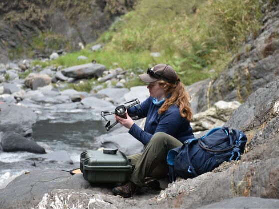
Preparing for a drone survey in the Western Central Range of Taiwan
| Photocredit: R. DiBiase
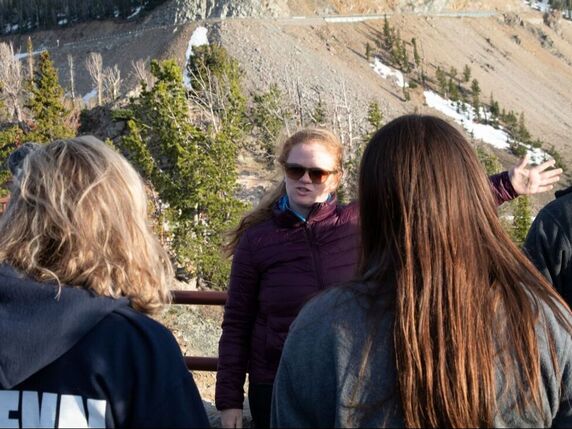
Teaching about glacial geomorphology at Beartooth Pass during field camp 2019.
| Photocredit: C. Oborn
|